Dong Van Karst Plateau Trekking is one of the most breathtaking adventures in northern Vietnam. Located in Ha Giang Province, this UNESCO-recognized limestone landscape offers dramatic mountain passes, ethnic villages, and unforgettable trekking routes.
However, planning a trek in such a remote and rugged region can be challenging. Weather conditions, terrain difficulty, and cultural sensitivity require careful preparation. That is why many travelers choose to explore Dong Van Karst Plateau Trekking with Vietpower Travel. With local expertise and responsible travel practices, your journey becomes both safe and deeply meaningful.
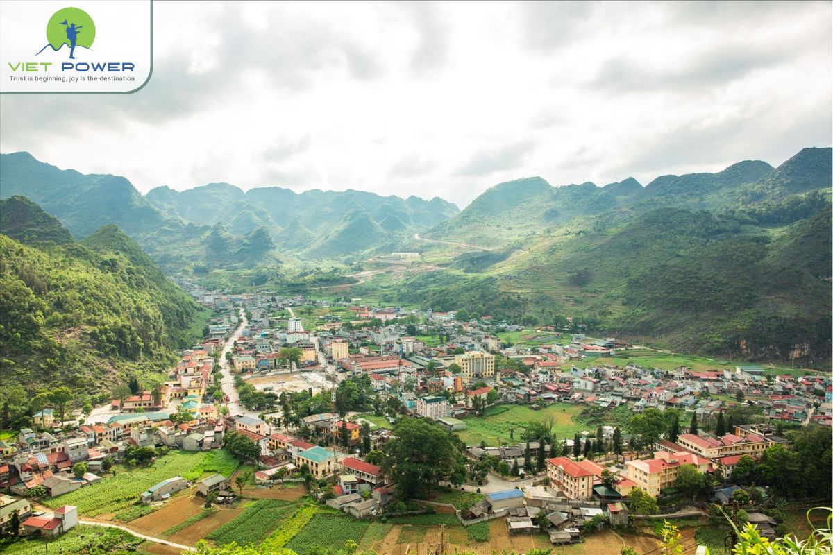
Dong Van Karst Plateau Trekking takes place in one of Vietnam’s most extraordinary geological regions. The plateau stretches across four districts of Ha Giang Province: Quan Ba, Yen Minh, Dong Van, and Meo Vac.
In 2010, the plateau was officially recognized as a UNESCO Global Geopark. According to UNESCO, the site preserves geological formations dating back more than 500 million years. Fossils, limestone peaks, and deep canyons reveal the Earth’s ancient history.
This recognition places Dong Van among the world’s most important geological heritage sites. As a result, the region attracts researchers, photographers, and trekkers alike.
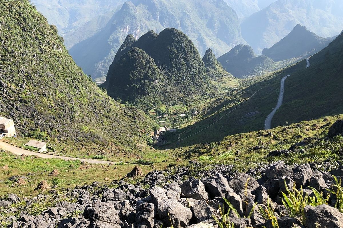
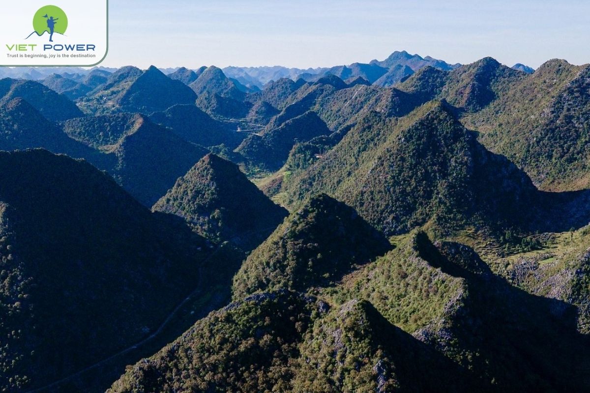
The landscape here is defined by towering limestone pinnacles, narrow valleys, and sharp mountain ridges. One of the most spectacular highlights is Ma Pi Leng Pass, often called the “King of Passes.”
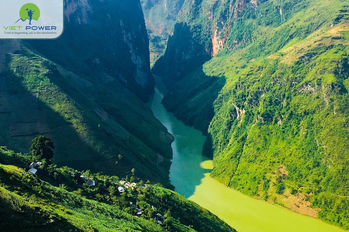
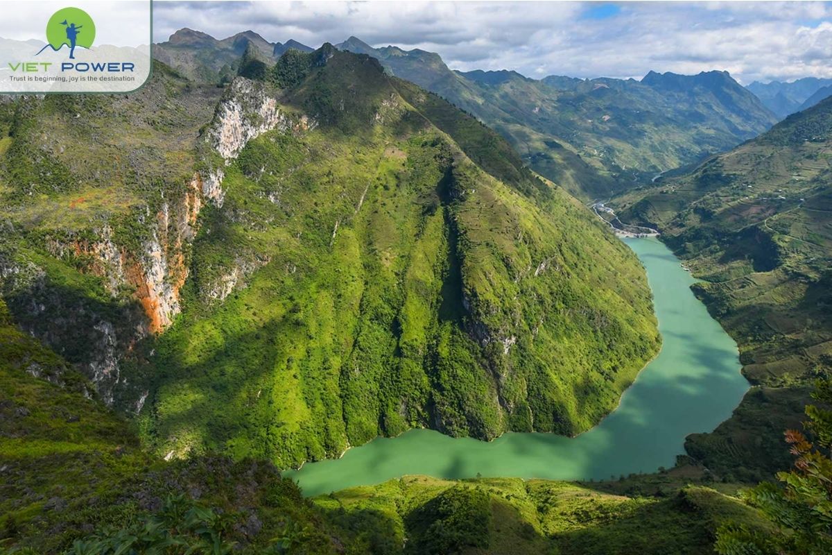
From the pass, trekkers can look down into the turquoise gorge carved by the Nho Que River. The cliffs are steep and dramatic. Meanwhile, mist often floats between the peaks at sunrise.
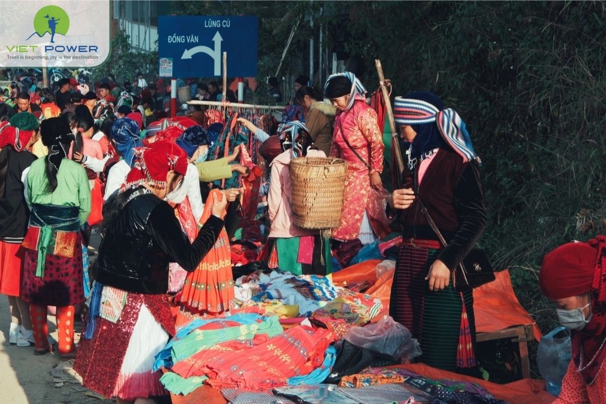
Beyond geology, Dong Van is home to more than 17 ethnic groups. These include the Hmong, Dao, Tay, Lo Lo, and Nung communities.
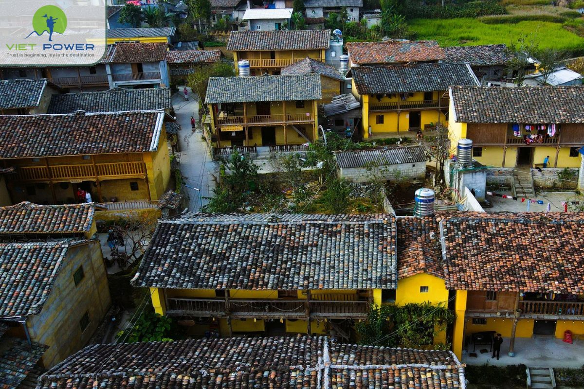
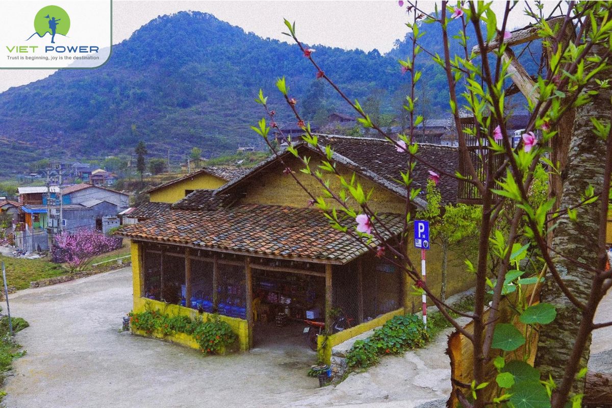
Each group maintains distinct traditions, costumes, and languages. Stone houses with clay walls dot the hillsides. Weekly markets bring villagers together in colorful gatherings. Therefore, Dong Van Karst Plateau Trekking is not only about landscapes but also about living culture.
Explore more posts within this topic and uncover even more of what makes Vietnam’s landscapes so unforgettable. Head to our Vietnam nature category for tips, stories, and travel recommendations.
Dong Van stands out for its rare combination of natural and cultural heritage. Few places in Southeast Asia offer such a balance.
The plateau contains sedimentary rock layers formed hundreds of millions of years ago. Fossils of marine organisms prove that this land was once under the sea.
These geological layers are visible along trekking trails. In some areas, limestone cliffs rise vertically from narrow valleys. Consequently, trekkers feel as if they are walking through an open-air geological museum.
Besides Ma Pi Leng Pass, the region features Heaven’s Gate in Quan Ba. This viewpoint overlooks the Twin Mountains and surrounding valleys.
The steep roads and winding passes create ever-changing scenery. Every turn reveals new perspectives of the limestone landscape. As a result, Dong Van Karst Plateau Trekking is visually dynamic and constantly inspiring.
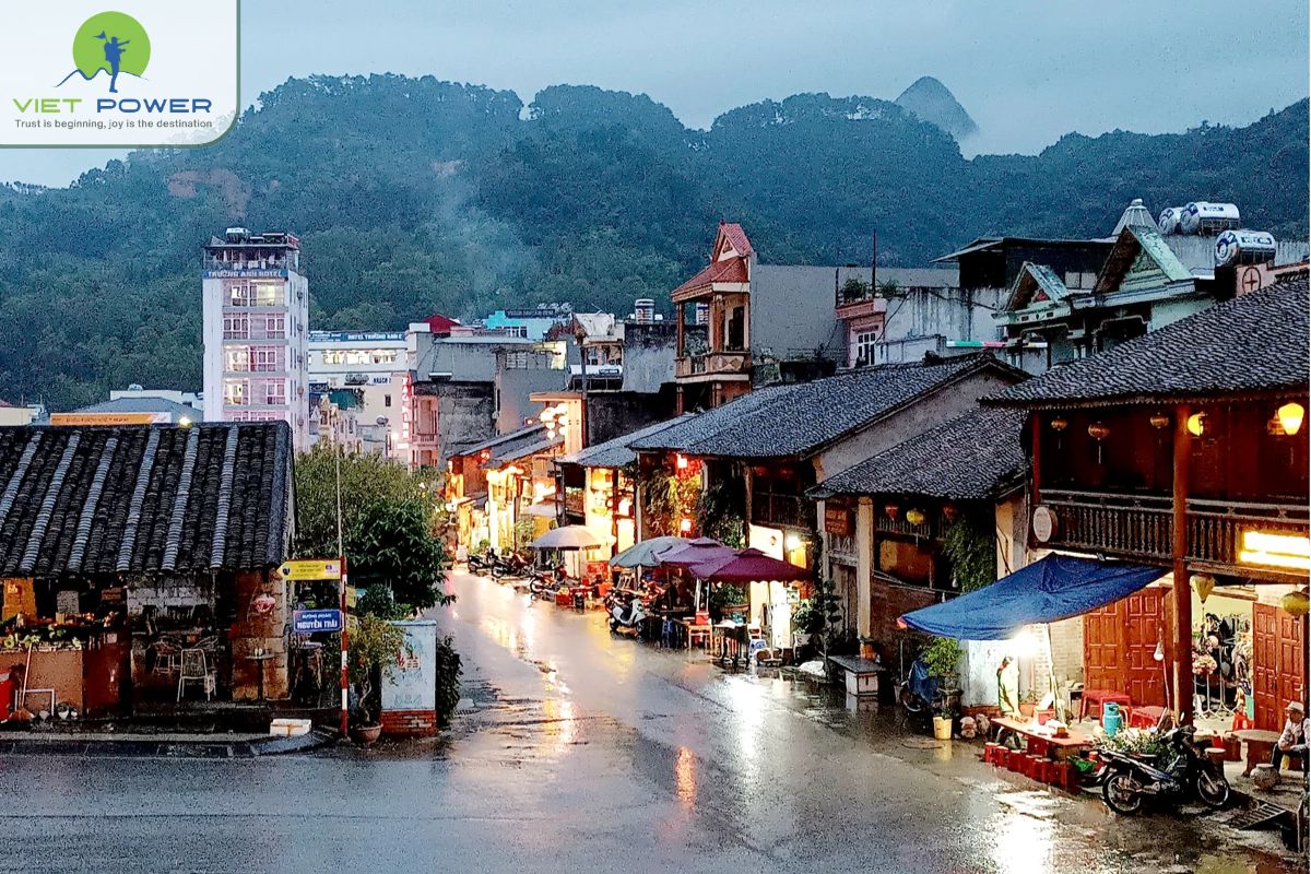
Dong Van Ancient Town reflects traditional architecture with clay-walled houses and tiled roofs. In addition, the Vuong Family Palace showcases the historical influence of the Hmong King.
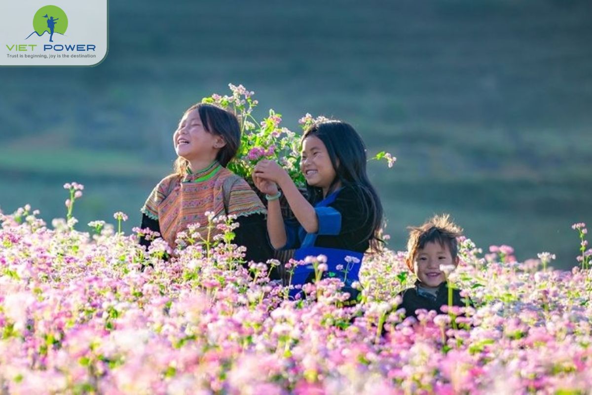
Seasonal festivals add another layer of uniqueness. The Buckwheat Flower Festival, held in autumn, covers the hills in pink and purple blossoms. Therefore, culture and nature blend seamlessly here.
What makes Dong Van different from other trekking destinations in Vietnam? Unlike Sapa or Pu Luong, Dong Van features dramatic limestone karst formations instead of forested mountains. The terrain is more rugged and rocky, offering sharper ridges and deeper canyons. In addition, the ethnic culture here remains highly authentic and less commercialized.
Ready to explore Vietnam’s stunning landscapes with a tailor-made journey designed just for you by Vietpower Travel?
Dong Van Karst Plateau Trekking offers routes for various fitness levels. Some are short and scenic. Others require endurance and experience.
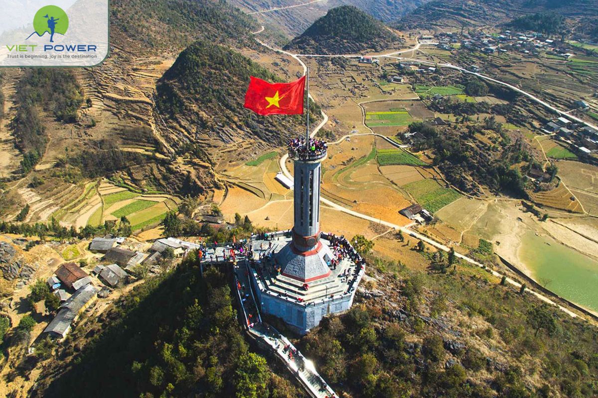
This route leads toward Vietnam’s northernmost point at Lung Cu Flag Tower. The trail passes through Hmong villages and rocky slopes.
The terrain is moderately challenging. However, the panoramic views from the top reward the effort. On clear days, you can see across the border mountains.
The “Lonely Tree” of Ha Giang: Along certain trekking routes near Dong Van and Yen Minh, you may spot a solitary tree standing against vast limestone hills. Locals often call it the “Lonely Tree.”
Although simple, it has become a symbol of strength and endurance in a harsh landscape. Many trekkers stop there for photos. However, it also reminds visitors of the quiet isolation that defines the plateau.
For experienced trekkers, the Ma Pi Leng Panorama Trail is unforgettable. The path follows high ridges overlooking the Nho Que River gorge.
Although the trail is narrow in places, it offers dramatic scenery. Therefore, it is ideal for adventurous travelers seeking iconic landscapes.
Did you know the name “Ma Pi Leng” roughly translates to “the bridge of a horse’s nose.” According to local legend, even a strong horse climbing the pass would be exhausted and breathing heavily by the summit.
The road across Ma Pi Leng was built in the 1960s by young volunteers who carved the cliffs manually using basic tools. It took years of dangerous labor to complete what is now one of Vietnam’s most iconic mountain roads.
This longer route connects two major towns in the plateau. It often takes one or two days, depending on pace.
Trekkers pass ethnic markets, terraced fields, and remote hamlets. Homestays along the way provide rest and cultural interaction. Consequently, this route combines nature and community experiences.
Village and Valley Walks: For beginners, shorter treks around Sung La and Lung Cam villages are suitable. The paths are less steep and more accessible. These routes focus on cultural immersion rather than altitude. You can explore traditional homes and interact with local families. Therefore, they are ideal for relaxed exploration.
You can find more posts related to this topic in the category below:
Proper preparation makes trekking safer and more enjoyable. Packing appropriate equipment and understanding health considerations help prevent common travel problems.
March to May: Pleasant Weather: Spring brings mild temperatures and blooming flowers. Trails are generally dry and easier to walk. The landscape appears fresh and green. Therefore, this period is ideal for comfortable trekking.
September to November: Golden and Floral Season: Autumn is considered the most beautiful time. Rice terraces turn golden, and buckwheat flowers bloom across the hills. The air is cool and clear. Consequently, visibility from mountain passes is excellent.
Seasonal Considerations: Summer can bring heavy rains, making trails slippery. Winter, on the other hand, can be cold and foggy. However, winter also offers dramatic misty landscapes. Therefore, each season has its own charm, but preparation is essential.
Most travelers spend 2–4 days trekking in the Dong Van region. A shorter trip focuses on key highlights like Ma Pi Leng and Lung Cu. Meanwhile, longer itineraries include remote villages and homestays.
People wonder “Do I need a guide for trekking in Dong Van?” While independent trekking is possible, hiring a local guide is highly recommended. Trails are not always clearly marked. A guide also enhances cultural understanding and ensures safe navigation.
Sturdy hiking boots provide stability on uneven terrain. Lightweight, moisture-wicking clothing keeps trekkers comfortable during long hikes. Layered outfits help adjust to changing temperatures, especially in mountainous areas.
A waterproof jacket protects against sudden rain. Trekkers should carry enough water, snacks and navigation tools. Sunscreen, hats and insect repellent are also essential, particularly for jungle routes and sunny mountain trails.
During colder months, thermal layers are necessary.
Continue exploring similar posts to learn more about Vietnam’s diverse landscapes and ecosystems:
During Dong Van Karst Plateau Trekking, travelers do not only explore limestone landscapes. They also meet ethnic communities who have lived here for generations. Each village reflects a unique culture shaped by harsh terrain and highland traditions.
Lo Lo Chai Village sits near Lung Cu Flag Tower, close to Vietnam’s northernmost point. The Black Lo Lo people live here in compact clay houses with yin-yang tiled roofs. Families build these houses with thick earthen walls to protect against cold winters and strong mountain winds.
When you walk through the village, you will notice colorful embroidery hanging in front of homes. Women create detailed patterns by hand. These designs reflect stories, beliefs, and daily life. If you visit a local house, families often explain the meaning behind their traditional clothing.
Sung La Valley is one of the most picturesque valleys in the region. Limestone peaks surround the valley, yet small fields of corn and buckwheat grow between rocks. In autumn, pink and purple flowers cover the hillsides. As a result, photographers and trekkers visit during buckwheat season.
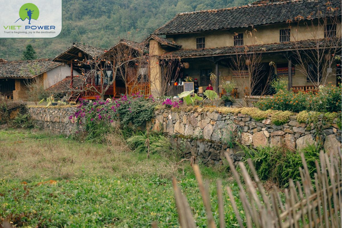
Nearby, Lung Cam Village preserves traditional Hmong houses built from stone and clay. These homes often feature wooden doors and tiled roofs. Families design their houses around open courtyards, where they dry corn and gather in the evening.
Nam Dam Village lies in Quan Ba district, at the gateway to the geopark. The Dao community lives here in traditional earthen houses. These homes blend into the hills because villagers use local soil to build them.
The Dao people strongly preserve their customs. Women wear red headscarves and embroidered clothing. In addition, families practice herbal medicine passed down through generations. Many visitors enjoy traditional herbal baths after a long trekking day. The warm water helps relax tired muscles.
Du Gia Village sits slightly outside Dong Van district. However, many itineraries include it in extended Dong Van Karst Plateau Trekking routes. The Tay ethnic group lives here in wooden stilt houses built along rivers and rice fields.
Unlike the rocky plateau, Du Gia features green valleys and waterfalls. This contrast surprises many trekkers. After days of walking across limestone terrain, the soft landscape feels refreshing. You can swim in natural pools or relax beside terraced fields.
Planning a trekking trip in Vietnam? Discover scenic landscapes, famous hiking routes, best seasons, safety tips and adventure travel ideas.
Dong Van Karst Plateau Trekking offers a rare combination of limestone landscapes, scenic passes, and vibrant ethnic villages. As a UNESCO Global Geopark, it preserves millions of years of geological history. At the same time, it protects living cultural traditions.
If you are ready to explore Ha Giang’s limestone wonderland, now is the perfect time. Contact Vietpower Travel today and begin your unforgettable Dong Van Karst Plateau Trekking adventure.
Please kindly send us your ideas about the tours: destinations, attractions, your group, hotel class... we will get back to you with details & best offers quickly. Surely, you will feel satisfactory!
 |
 |
 |
 |
 |
 |
.jpg) Customize Your Trip
Customize Your Trip
 Vietnam Tours
 Thailand Tours
 Laos Tours
 Indonesia Tours
 Cambodia Tours
 Myanmar Tours